This started with a simple question during fire season: what is actually happening over that ridge? The information exists, but it tends to be scattered across systems that feel designed for people who already know exactly where to look.
A statewide glance
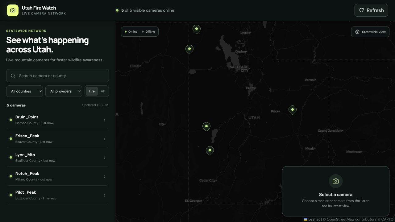
Utah Fire Watch pulls the public AlertWest camera feed into one dark, map-first view. It filters down to Utah, plots the available cameras, and gives me search and county filters when I need to get specific. Pick a camera and the latest still is right there. No tour of twelve browser tabs required.
The goal was not another emergency dashboard. It was a clean window into the cameras already doing the watching.
The useful bits
- Live Utah camera availability on one map.
- Search by camera name or county.
- Fresh still images with an automatic three-minute refresh.
- A view-line overlay when the camera data includes a direction.
What I like about it
It is small, direct, and immediately useful. The public endpoint returns what the browser needs, so the first version does not need a backend or an elaborate data pipeline. I like projects that earn their complexity slowly.
This is still a garden project. More cameras, better context, and a few smarter fire-season details can grow from here. For now, it answers the question I actually had.